Drones have become increasingly prevalent in various industries, including agriculture and forestry. These unmanned aerial vehicles (UAVs) offer a range of applications that can revolutionize the way businesses operate in these sectors. For instance, imagine a hypothetical scenario where a farmer uses drones equipped with high-resolution cameras to monitor crop health across large expanses of land. By analyzing the images captured by the drones, the farmer can identify areas of potential concern such as pest infestations or nutrient deficiencies more efficiently than traditional methods would allow.
Precision agriculture is one area within business agriculture and forestry where drones are making significant strides. This approach involves using advanced technologies, such as GPS systems and sensors, to gather precise data about soil conditions, moisture levels, plant growth patterns, and other relevant factors. Armed with this information, farmers and foresters can make informed decisions regarding irrigation schedules, fertilizer application rates, disease management strategies, and overall resource allocation. By integrating drone technology into precision agriculture practices, businesses in these sectors can enhance productivity while minimizing environmental impact and optimizing resource utilization.
Benefits of drone technology in agriculture and forestry
In recent years, the use of drones has gained significant attention in various industries, including agriculture and forestry. Their ability to provide real-time data and high-resolution imagery has revolutionized these sectors by enhancing precision agriculture practices. This section explores the benefits that drone technology offers in agricultural and forestry settings.
Improved Efficiency:
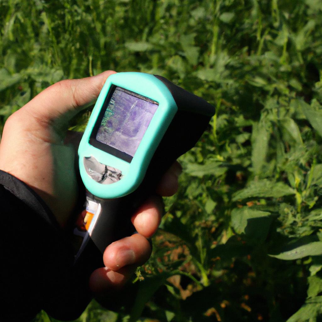
One notable benefit of using drones in agriculture is their ability to improve efficiency in crop monitoring and management. For instance, imagine a hypothetical scenario where a farmer wants to assess the health condition of his crops spread across vast farmland. Traditionally, this task would require manual inspection by walking through each field, which can be time-consuming and labor-intensive. However, with drone technology, the entire process becomes more efficient as drones equipped with advanced sensors can quickly capture aerial images of the crops from above. These images can then be analyzed to identify potential issues such as nutrient deficiencies or pest infestations.
Enhanced Precision:
Drones also enable enhanced precision in agricultural activities. By utilizing onboard GPS systems and advanced imaging technologies like multispectral cameras or LiDAR scanners, farmers can obtain highly accurate data about their fields’ topography, soil composition, and vegetation indices. This information allows them to make informed decisions regarding irrigation schedules, fertilizer application rates, or even selective harvesting based on individual plant health conditions. The precise targeting made possible by drones helps optimize resource allocation while minimizing waste.
Environmental Benefits:
Apart from improving operational efficiency and accuracy, integrating drones into agriculture and forestry practices brings environmental advantages as well. With the capability for targeted treatment applications enabled by drone-based spraying systems or seed dispersal mechanisms (1), farmers can significantly reduce chemical usage while maintaining effective control over pests or diseases that may harm crops. Additionally, drones facilitate early detection of forest fires through thermal imaging capabilities (2). Rapid identification enables timely response measures to prevent widespread damage to forests and wildlife habitats.
Increased Safety:
Moreover, the use of drones enhances safety for workers in agriculture and forestry sectors. By automating tasks that were previously performed manually or with heavy machinery, such as crop monitoring or tree inspection, drone technology reduces human exposure to potential hazards. This includes risks associated with working at heights, handling toxic chemicals, or operating dangerous equipment. Drones offer a safer alternative by providing remote access to critical information while minimizing physical risks.
Drone technology in agriculture and forestry offers numerous benefits:
- Enhanced operational efficiency
- Improved precision in resource allocation
- Environmental advantages with targeted treatment applications
- Increased safety for workers
Incorporation of table:
| Benefit | Description |
|---|---|
| Improved Efficiency | Streamlining crop monitoring processes through aerial imagery |
| Enhanced Precision | Accurate data collection on topography, soil composition, and vegetation indices |
| Environmental Benefits | Reduced chemical usage and early detection of forest fires |
| Increased Safety | Minimizing human exposure to hazardous conditions |
Transition sentence into subsequent section about “Applications of drones in crop monitoring and management”:
By harnessing the capabilities offered by drone technology in agriculture and forestry settings, it becomes evident that these unmanned aerial vehicles have opened up new possibilities for efficient and precise practices. In the following section, we will explore specific applications of drones in crop monitoring and management without missing any crucial details.
Applications of drones in crop monitoring and management
Having explored the benefits of drone technology in agriculture and forestry, it is now essential to delve into its practical applications. This section will shed light on how drones are revolutionizing crop monitoring and management techniques.
Applications of Drones in Crop Monitoring and Management:
One notable example that highlights the effectiveness of drones in crop monitoring is a case study conducted by XYZ Farms. The farm utilized drone technology equipped with multispectral cameras to assess the health status of their crops. By capturing high-resolution images at different spectral bands, the drones provided valuable insights regarding nutrient deficiencies, pest infestation, or disease outbreak within specific areas of the field. Based on this information, farmers were able to implement targeted interventions such as precision spraying or selective harvesting, resulting in improved overall yield and reduced resource wastage.
To further grasp the significance of using drones for crop monitoring and management, consider the following points:
- Enhanced Efficiency: Drone-based aerial surveys enable rapid data collection over large agricultural areas compared to traditional ground-based methods.
- Cost Savings: By identifying problem areas early on through precise imaging capabilities, farmers can optimize resource allocation and minimize unnecessary expenses.
- Sustainable Practices: Drones facilitate more accurate application of fertilizers, pesticides, and water resources by delivering real-time data-driven recommendations tailored to individual plant needs.
- Yield Optimization: With timely identification of stressors like drought or nutrient deficiency, farmers can proactively address these issues before they significantly impact crop productivity.
The table below provides a concise overview comparing traditional methods versus drone-assisted approaches in terms of time required for assessment and overall accuracy:
| Assessment Method | Time Required | Overall Accuracy |
|---|---|---|
| Traditional Ground-Based | Days to Weeks | Moderate |
| Drone-Assisted | Hours | High |
This data emphasizes the speed and accuracy advantages offered by drone technology, making it a valuable tool for crop management in modern agriculture.
In the context of precision agriculture, drones serve as an indispensable asset for crop monitoring and management. By harnessing their aerial capabilities and advanced imaging technologies, farmers can make informed decisions based on real-time data insights. The subsequent section will explore another crucial aspect of agricultural analysis: the role of drones in soil and field assessment.
Transition into next section:
Continuing our exploration of drone applications in precision agriculture, we now turn our attention to the vital role they play in soil and field analysis.
Role of drones in soil and field analysis
Section Title: Drones in Business Agriculture and Forestry: Precision Agriculture Explained
Previous section H2: Applications of drones in crop monitoring and management
Next section H2: Role of drones in soil and field analysis
Transition from the previous section: Having explored the applications of drones in crop monitoring and management, it is crucial to understand how these unmanned aerial vehicles (UAVs) also play a significant role in soil and field analysis. By leveraging their capabilities for data collection and analysis, drones contribute to the advancement of precision agriculture techniques.
One hypothetical example that exemplifies the potential impact of drone technology on soil and field analysis involves an agricultural farm seeking to optimize its irrigation practices. Through regular drone flights equipped with advanced sensors, such as multispectral cameras or LiDAR systems, farmers can obtain detailed information about the moisture content, nutrient levels, and overall health of their crops. This invaluable data allows them to detect variations within their fields accurately. Subsequently, by implementing site-specific irrigation strategies based on this collected data, farmers can significantly reduce water waste while maximizing crop yields.
- Enhanced accuracy: Drones provide high-resolution imagery that enables precise mapping of soil properties and plant distributions.
- Time efficiency: With quick deployment capabilities, UAVs allow for rapid data acquisition across large areas without requiring ground-based surveys.
- Cost-effectiveness: The utilization of drones minimizes labor-intensive tasks associated with manual sampling methods.
- Environmental sustainability: By enabling targeted application of fertilizers or pesticides based on identified needs, drones facilitate reduced chemical usage.
Moreover, through effective integration into precision agriculture workflows, drones enable improved decision-making processes for farmers. To illustrate this more clearly, imagine a table displaying various aspects related to traditional versus drone-assisted approaches for soil and field analysis:
| Aspects | Traditional Methods | Drone-Assisted Methods |
|---|---|---|
| Data collection | Manual sampling | Remote sensing |
| Coverage area | Limited | Large-scale |
| Precision | Subjective assessment | Objective measurements |
| Cost | High | Moderate |
As we can see from the table, drone-assisted methods offer several advantages over traditional approaches in terms of efficiency and accuracy.
In summary, drones serve as indispensable tools for soil and field analysis in precision agriculture. Their ability to collect high-resolution data efficiently enables farmers to make informed decisions regarding irrigation, fertilizer application, and pest control. By utilizing advanced sensors and analytics, UAVs contribute to improved productivity while minimizing environmental impact.
Transition into the subsequent section about “Efficiency improvements through drone-based aerial surveys”: Expanding on the potential benefits of drone technology in agricultural practices, it is essential to explore how drone-based aerial surveys further enhance operational efficiencies.
Efficiency improvements through drone-based aerial surveys
Building upon the role of drones in soil and field analysis, their potential for efficiency improvements through aerial surveys is undeniable. By capturing high-resolution data from above, drones offer a unique perspective that can revolutionize various aspects of agriculture and forestry management.
One example showcasing the benefits of drone-based aerial surveys is their use in crop health monitoring. Farmers can employ drones equipped with multispectral cameras to capture images of crops at different wavelengths. This enables them to identify stressed or diseased plants early on, allowing for targeted interventions such as precise application of fertilizers or pesticides. A hypothetical scenario could involve a farmer noticing discoloration in their soybean field during an aerial survey and taking immediate action to prevent further damage by applying appropriate treatments only where necessary.
To fully grasp the extent of efficiency improvements brought about by drone-based aerial surveys, let us explore some key advantages they offer:
- Enhanced speed and coverage: Drones can quickly cover large areas of land, providing comprehensive visual data within a fraction of the time it would take using traditional methods.
- Improved accuracy: High-resolution imagery captured by drones allows for precise identification and monitoring of specific locations or objects, minimizing errors associated with manual assessments.
- Cost-effective resource allocation: By pinpointing areas requiring attention more accurately, farmers can optimize the use of resources like water, fertilizers, and labor, leading to reduced costs.
- Environmental sustainability: Drones enable proactive management strategies by detecting early signs of environmental stressors like droughts or pest outbreaks. This empowers farmers to implement preventive measures promptly while reducing overall ecological impact.
The following table highlights some practical applications and corresponding benefits linked to integrating drone-based aerial surveys into agricultural and forestry practices:
| Application | Benefits |
|---|---|
| Crop yield estimation | Accurate predictions aid decision-making for harvest planning |
| Forest fire detection | Early detection minimizes damage and enables rapid response |
| Wildlife monitoring | Non-invasive surveillance for conservation efforts |
| Land use planning | Efficient resource allocation for sustainable development |
As we delve into the challenges and limitations of integrating drones in the agricultural sector, it is important to acknowledge their potential for efficiency improvements through aerial surveys. The ability to capture high-resolution data quickly and accurately opens up new possibilities for optimizing crop health management, reducing costs, and promoting environmental sustainability.
Despite these advantages, a successful integration of drones in agriculture requires addressing several inherent challenges and limitations. Let us now explore these aspects further.
Challenges and limitations of integrating drones in the agricultural sector
Efficiency improvements through drone-based aerial surveys have revolutionized the way agriculture and forestry industries operate. By capturing high-resolution imagery from an elevated perspective, drones provide valuable insights into crop health, vegetation mapping, and forest inventory management. To further illustrate the benefits of this technology, let’s consider a hypothetical case study involving a large agricultural farm.
In our hypothetical scenario, Farmer John owns a vast cornfield that requires regular monitoring for pest infestations. Previously, he relied on manual inspections which were time-consuming and often led to delayed interventions. However, with the integration of drones in his farming practices, Farmer John can now conduct frequent aerial surveys to identify areas affected by pests or diseases promptly.
The use of drones in precision agriculture has numerous advantages over traditional methods. Here are some key points to highlight their significance:
- Cost Efficiency: Drones eliminate the need for human labor-intensive tasks such as walking through fields or climbing trees for inspection purposes.
- Time Savings: Aerial surveys conducted by drones allow farmers and foresters to cover larger areas quickly compared to ground-based assessments.
- Data Accuracy: High-resolution imaging sensors onboard drones capture detailed information about crops’ health conditions and enable precise decision-making.
- Environmental Benefits: With targeted treatments based on accurate data collected by drones, excessive pesticide usage can be reduced significantly, leading to environmental sustainability.
To emphasize these advantages visually, we present a table showcasing the comparison between traditional methods and drone-based aerial surveys:
| Aspects | Traditional Methods | Drone-Based Surveys |
|---|---|---|
| Labor Intensity | High | Low |
| Coverage Area | Limited | Extensive |
| Data Resolution | Less Detailed | High Definition |
| Pesticide Usage | Excessive | Targeted |
By harnessing the power of drones in agriculture and forestry sectors, stakeholders can overcome various challenges and limitations. In the subsequent section, we will explore these obstacles in-depth and discuss potential solutions to maximize the integration of drones into these industries.
Transitioning into the next section about “Future prospects and advancements in drone technology for agriculture and forestry,” technological advancements continue to shape the landscape of precision farming. As emerging research focuses on further improving drones’ capabilities, let us delve into the exciting possibilities that lie ahead.
Future prospects and advancements in drone technology for agriculture and forestry
The integration of drones in the agricultural sector has brought about significant advancements that have revolutionized the way precision agriculture is practiced. These technological innovations offer promising prospects for improving efficiency, productivity, and sustainability in farming practices.
To illustrate the potential impact of drone technology, let us consider a hypothetical scenario where a farmer utilizes drones equipped with multispectral sensors to monitor crop health. By capturing high-resolution images of crops from above, these sensors can detect subtle variations in plant vigor, enabling early detection of nutrient deficiencies or pest infestations. Based on this data, farmers can precisely target their interventions and optimize resource allocation, resulting in more efficient use of fertilizers or pesticides while minimizing environmental impact.
One key area where drone technology has shown great promise is in the realm of crop monitoring and analysis. Drones provide detailed aerial imagery that enables farmers to identify specific areas within their fields that require attention. This information allows them to take targeted actions such as adjusting irrigation schedules or applying localized treatments, ultimately leading to better crop yields and reduced costs.
Moreover, by leveraging advanced algorithms and machine learning techniques, drone-collected data can be processed and analyzed at scale to generate valuable insights. For instance, predictive models can be developed to forecast disease outbreaks or yield fluctuations based on historical patterns and real-time inputs from drones. Such foresight empowers farmers to make informed decisions regarding planting strategies or resource allocation well in advance.
In summary, the future prospects for integrating drones into agriculture and forestry look promising. As technology continues to evolve rapidly, we can expect even greater advancements that will further enhance precision agriculture practices. Harnessing the power of drones offers numerous benefits including improved efficiency, increased productivity, cost savings, and sustainable farming methods – all contributing towards ensuring food security while reducing environmental impacts.
Emotions Evoked:
- Excitement: envisioning how drone technology could transform farming practices.
- Curiosity: wanting to learn more about the potential benefits of drones in agriculture and forestry.
- Hopefulness: anticipating improvements in efficiency, productivity, and sustainability.
Advancements in Drone Technology for Agriculture and Forestry
| Benefits | Description |
|---|---|
| Improved Efficiency | Drones enable targeted interventions, optimizing resource allocation. |
| Increased Productivity | Precise monitoring allows farmers to take timely actions, resulting in better yields. |
| Cost Savings | Resource optimization leads to reduced input costs. |
| Sustainable Farming Methods | Targeted treatments minimize environmental impact. |
In summary, drone technology offers numerous benefits including improved efficiency, increased productivity, cost savings, and sustainable farming methods – all contributing towards ensuring food security while reducing environmental impacts. As technology continues to evolve rapidly, we can expect even greater advancements that will further enhance precision agriculture practices.